Black Butte Lookout Site (Shasta-Trinity National Forest)
US 2008, CA 128
Black Butte Lookout
Lookout Details
| Registry Numbers | US 2008, CA 128 (view other lookout sites in United States, California) |
| Date Registered | April 15, 2020 |
| Nominated by | Brad Eells |
| Location |
Shasta-Trinity National Forest Siskiyou County, California |
| Coordinates |
N 41° 21.992' W 122° 20.887' (view using Google Maps) N 41° 21' 60" W 122° 20' 53" N 41.366537° W 122.348119° |
| Elevation | 6,337 ft (1,932 m) |
| Built | 1963 |
| Removed | 1977 |
| Administered by | US Forest Service - Shasta-Trinity National Forest |
Description
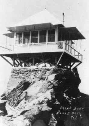
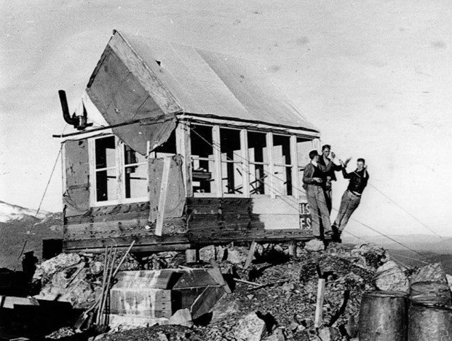
Black Butte may have hosted at least 3 different structures during it's time a fire detection site. The first, a canvas peak roof, rectangular building with little foundation. The second, a California Region 5 Plan 4AR ground cabin that was blown off the mountain in 1962. The third, a C-16 all steel cabin constructed in 1963 that was relocated to Hogback Mountain in 1977.
Map
Change Basemap
Photos
Peak Canvas Roof