Castro Peak Lookout - 1958
Lookout Details
| Registry Numbers | US 1928, CA 108 (view other lookout sites in United States, California) |
| Date Registered | February 26, 2020 |
| Nominated by | Brad Eells |
| Location | Los Angeles County, California |
| Coordinates |
N 34° 05.141' W 118° 47.136' (view using Google Maps) N 34° 05' 08" W 118° 47' 08" N 34.085681° W 118.785596° |
| Elevation | 2,829 ft (862 m) |
| Built | 1925 |
| Removed | 1978 |
| National Historic Lookout Register | 1289 |
| Administered by | Los Angeles County Fire Department |
Description
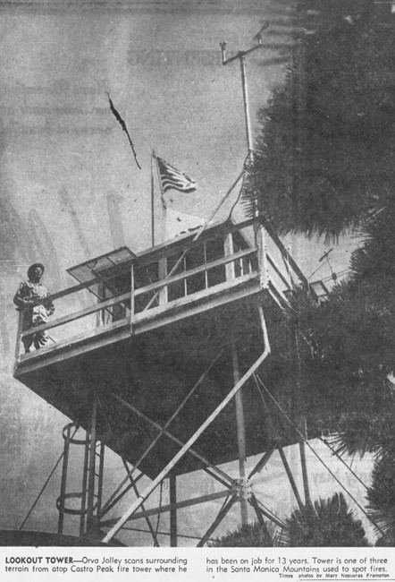
Built in 1925 on Castro Peak, the highest point in the Malibu Hills west of Los Angeles at coordinates N 34.085989 W 118.785362, Castro Peak Lookout was an 8'x8'-foot metal cab on a 22-foot tower. It was built and operated by the Los Angeles County Forestry Department until it went out of service in 1971. In approximately 1978, it was moved to L.A. County Fire Department’s Henninger Flats Forestry Unit, which occupies an island of county property in the Angeles National Forest on the south slope of Mt. Wilson, site of an historic observatory. At Henninger Flats, the tower was refurbished, stocked with 1925 period artifacts, and mounted on a 7-foot tower as a historic public education display, and part of the Forestry Unit’s visitor center/museum.
In 2025 the Los Angeles Country Fire Departrment dismantled the lookout at the Henninger site. Their intention is to erect it on the Los Angeles County Fairgrounds (Fairplex) in Pomona, California. There it will be part of the America’s Great Outdoors exhibit area, along with the former Johnstone Peak Lookout.
Map
Photos
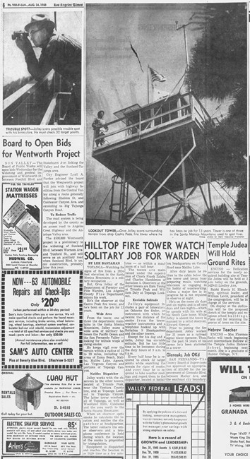
August 24, 1958