Cherry Hill Lookout Site
US 1958, CA 112
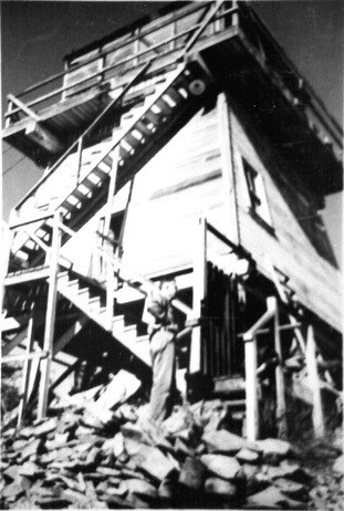
Cherry Hill Lookout
Lookout Details
| Registry Numbers | US 1958, CA 112 (view other lookout sites in United States, California) |
| Date Registered | April 1, 2020 |
| Nominated by | Brad Eells |
| Location |
Tahoe National Forest Nevada County, California |
| Coordinates |
N 39° 25.023' W 120° 47.867' (view using Google Maps) N 39° 25' 01" W 120° 47' 52" N 39.417046° W 120.797783° |
| Elevation | 5,050 ft (1,539 m) |
| Built | 1933 |
| Removed | Unknown |
| Administered by | US Forest Service - Tahoe National Forest |
Description
Constructed in 1933, Cherry Hill was a California Region 5 Plan BC-301 cabin on a 16 foot enclosed timber tower.
Removal date is unknown.
Map
Change Basemap