Grapevine Peak Lookout Site
US 1855, CA 50
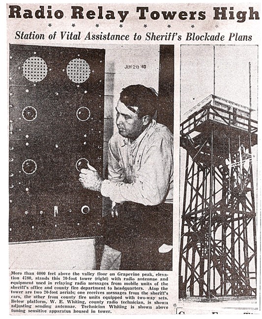
Grapevine Peak Lookout - 1940
Lookout Details
| Registry Numbers | US 1855, CA 50 (view other lookout sites in United States, California) |
| Date Registered | December 15, 2019 |
| Nominated by | Brad Eells |
| Location | Kern County, California |
| Coordinates |
N 34° 54.181' W 118° 54.268' (view using Google Maps) N 34° 54' 11" W 118° 54' 16" N 34.903012° W 118.904461° |
| Elevation | 4,816 ft (1,468 m) |
| Built | Circa 1940 |
| Removed | Unknown |
| Administered by | Kern County Fire Department |
Description
Grapevine Peak may have been constructed for the Kern County Fire Department prior to 1940. The site does not appear on Thornton's 1986 survey but is noted as a county structure on Ron Kemnow's site.
The structure appears to be a 14x14 cabin similar to a US Forest Service L-4 design on a 30 foot open timber tower.
The removal date is unknown. Grapevine Peak remains a busy communications site.
Map
Change Basemap
Photos
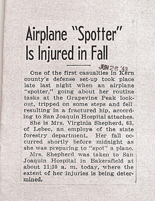
Aircraft Warning Service Article - 1943