1946
Lookout Details
| Registry Numbers | US 1866, CA 61 (view other lookout sites in United States, California) |
| Date Registered | December 21, 2019 |
| Nominated by | Brad Eells |
| Location | Sonoma County, California |
| Coordinates |
N 38° 40.154' W 122° 37.999' (view using Google Maps) N 38° 40' 09" W 122° 37' 60" N 38.669241° W 122.633310° |
| Elevation | 4,340 ft (1,323 m) |
| Built | 1950 |
| Removed | After 1992 |
| Administered by | California Department of Forestry and Fire Protection |
Description
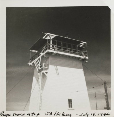
A lookout was constructed and dedicated in 1935, similar to a US Forest Service Plan BC-301 cabin on a 30 foot enclosed tower.
This lookout was replaced in 1950:
The lookout conformed closely to the 809R plan. The few changes are: aluminum siding, asphalt composition roofing and steel fire escape ladder with steel catwalk trap door added (ladder and door were originally wood). The tower's aluminum frame windows may also be non-original. There has been some interior remodeling. Only a few of the 809R towers have a ground entry annex. These 3'xll'x7' (high) shed roof additions have either been removed or were not installed to begin with. Mount Saint Helena Lookout is in near original condition. This tower is based on the newer 809R design (after 1950) and, thus, incorporates tilted cab windows with steel columns (mullions) for added roof support.
Mount Saint Helena is a large brush covered prominence within the Mayacmas Mountains. There is a scattering of pine and fir near the summit. The detection point has a commanding view, looking into seven (7) different counties. The lookout is located within Sonoma County just west of the LakeNapa-Sonoma County boundary junction. There are numerous communications facilities at this site. Public access is limited to pedestrians only. The lookout is 5.7 miles from the nearest paved road. (MVT 10/91)
The lookout ceased to be staffed in 1992 and was removed some time after that. Mount Saint Helena is the highest point in Sonoma County.
Map
Photos
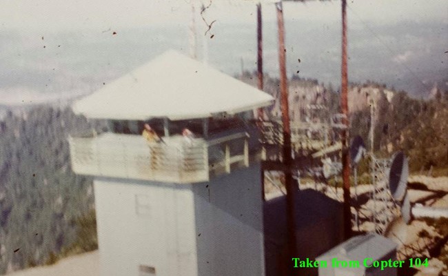
809R built in 1950