West Libre Lookout Site
US 1791, CA 37
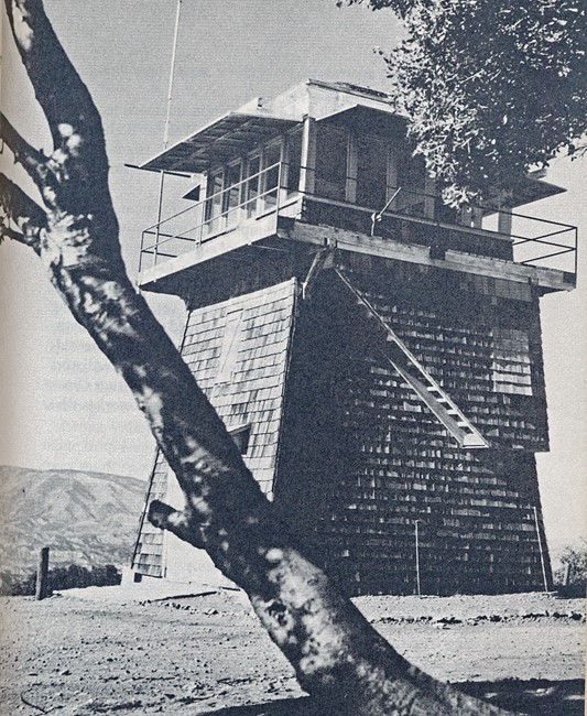
West Libre Lookout
Lookout Details
| Registry Numbers | US 1791, CA 37 (view other lookout sites in United States, California) |
| Date Registered | November 3, 2019 |
| Nominated by | Brad Eells |
| Location |
Angeles National Forest Los Angeles County, California |
| Coordinates |
N 34° 43.585' W 118° 42.147' (view using Google Maps) N 34° 43' 35" W 118° 42' 09" N 34.726411° W 118.702448° |
| Elevation | 5,112 ft (1,558 m) |
| Built | 1936 |
| Removed | 1969 (Burned) |
| Administered by | US Forest Service - Angeles National Forest |
Description
West Libre Lookout was constructed in 1936 by the Angeles National Forest. The structure was a California Region 5 Plan BC-301 cabin on a 20 foot enclosed timber tower.
Purposely burned by USFS personnel in 1969.
Map
Change Basemap