Barnstable Tower Site
US 35, MA 35
Lookout Details
| Registry Numbers | US 35, MA 35 (view other lookout sites in United States, Massachusetts) |
| Date Registered | September 3, 2008 |
| Nominated by | Henry Isenberg |
| Location |
Shoot Flying Hill Barnstable County, Massachusetts |
| Coordinates |
N 41° 41.010' W 070° 20.570' (view using Google Maps) N 41° 41' 01" W 070° 20' 34" N 41.683500° W 070.342830° |
| Elevation | 200 ft (61 m) |
Description
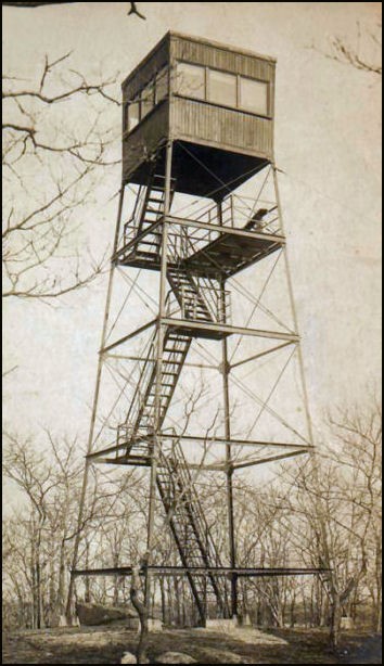
The first tower used by the state was wooden and built by public subscription in 1897. In 1912, 10' was added to the top of the watchman's cabin. In 1914, a new 48' steel tower was erected. Barnstable contributed $350 and Yarmouth contributed $150 toward this tower. At this time, the first telephone line to the tower was laid. It was one mile in length. In 1937, two-way radios were installed. This tower was removed in 1947 to make way for the new U.S. Highway Rte. 6.
Map
Change Basemap
Photos