Big Stamp Lookout Site
US 1737, NC 2
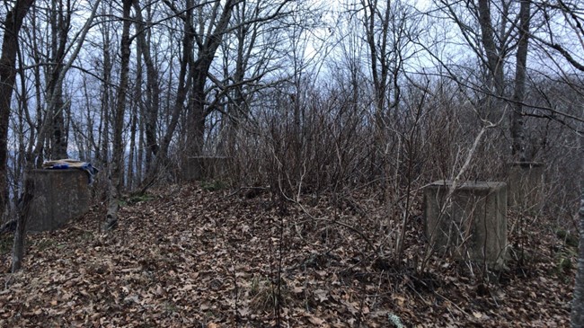
Concrete footings from the tower
Lookout Details
| Registry Numbers | US 1737, NC 2 (view other lookout sites in United States, North Carolina) |
| Date Registered | December 11, 2018 |
| Nominated by | Victoria Oliver |
| Location |
Nantahala National Forest Clay County, North Carolina |
| Coordinates |
N 35° 08.335' W 083° 49.054' (view using Google Maps) N 35° 08' 20" W 083° 49' 03" N 35.138917° W 083.817562° |
| Elevation | 4,437 ft (1,352 m) |
| Removed | 1960s |
| Administered by | U.S. Forest Service |
Description
According to U.S. Forest Service resources, Big Stamp Bald was as a seasonal meeting place for two Native American tribes in pre-European times. The Valley River Tribe (from the Andrews area) and the Spike Buck Tribe (from the Hayesville area) would hike to the bald for gatherings and dances.
Eventually, the location was deemed useful for fire observation and a U.S. Forest Service fire tower was constructed. The last fire warden, Glen Beaver, called in the final fire, burning near Tipton, North Carolina, from the tower in the 1960s.
As of 2018, concrete footers, a water cistern, and underground storm shelter remain at the site.
Map
Change Basemap