Clara Peak Lookout Site
US 1603, NM 2
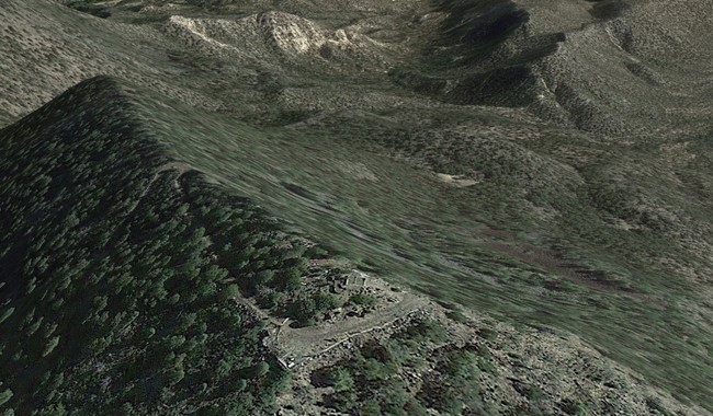
Google Earth imagery of ruins
Lookout Details
| Registry Numbers | US 1603, NM 2 (view other lookout sites in United States, New Mexico) |
| Date Registered | August 30, 2015 |
| Nominated by | Mark Gutzman |
| Location |
Santa Fe National Forest Rio Arriba County, New Mexico |
| Coordinates |
N 36° 02.142' W 106° 14.424' (view using Google Maps) N 36° 02' 09" W 106° 14' 25" N 36.035702° W 106.240398° |
| Elevation | 8,551 ft (2,606 m) |
| Built | 1951 |
| Administered by | U.S. Forest Service |
Description
Clara Peak Lookout formerly stood in Espanola Ranger District of the Santa Fe National Forest. Built in 1951, it featured a 14'x14' L-4 ground house constructed of stuccoed cinderblocks. It had metal frame windows with wooden shutters and a wood frame roof. An outhouse, storage shed, and cistern were also constructed at the same time as the lookout.
The tower was removed sometime between 1988 and 2015.
Map
Change Basemap