Mount Hood Lookout Site
US 605, OR 46
Lookout Details
| Registry Numbers | US 605, OR 46 (view other lookout sites in United States, Oregon) |
| Date Registered | August 26, 2010 |
| Nominated by | Ray Kresek |
| Location |
Mount Hood Region Hood River County, Oregon |
| Coordinates |
N 45° 22.405' W 121° 41.754' (view using Google Maps) N 45° 22' 24" W 121° 41' 45" N 45.373410° W 121.695900° |
| Elevation | 11,245 ft (3,427 m) |
| Administered by | U.S. Forest Service |
Description
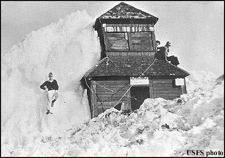
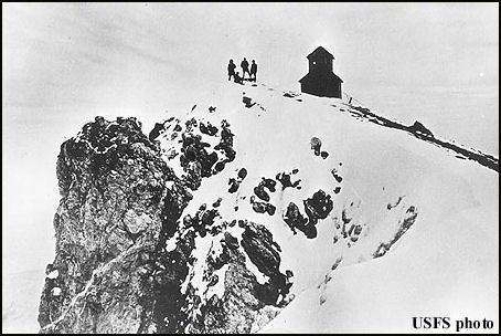
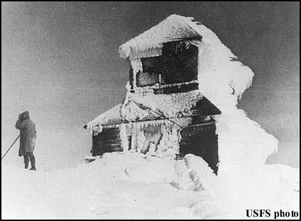
The USFS constructed a firefinder on top of the summit cairn and a tent with a wooden floor in 1915. This was replaced later the same year by a Lige Coleman prototype for the D-6 cupola cabin. Abandoned in 1935, the cabin slipped off the summit in 1941.
Map
Change Basemap
Photos
1928 (photos courtesy Fire Lookout Museum)
1921 (photos courtesy Fire Lookout Museum)