Olallie Butte Lookout Site
US 632, OR 66

Lookout Details
| Registry Numbers | US 632, OR 66 (view other lookout sites in United States, Oregon) |
| Date Registered | September 19, 2010 |
| Nominated by | Ray Kresek |
| Location |
Mount Hood National Forest Jefferson County, Oregon |
| Coordinates |
N 44° 49.301' W 121° 45.829' (view using Google Maps) N 44° 49' 18" W 121° 45' 50" N 44.821680° W 121.763810° |
| Elevation | 7,215 ft (2,199 m) |
| Administered by | Warm Springs Indian Reservation |
Description
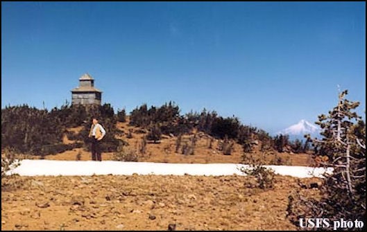
In 1915, the USFS built a 30' steel windmill tower with 6'x6' cab and a tent cabin. A cupola cabin was built in 1920 and was abandoned in 1967. The cupola fell through the roof in 1982, but the remains are still on the summit. The site is now on the Warm Springs Indian Reservation.
Map
Change Basemap
Photos
1953