Porcupine Ridge Lookout Site
US 1079, OR 437
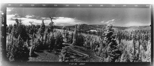
Porcupine Ridge Lookout panoramic 7-22-1935
Lookout Details
| Registry Numbers | US 1079, OR 437 (view other lookout sites in United States, Oregon) |
| Date Registered | June 25, 2011 |
| Nominated by | Ray Kresek |
| Location |
Umatilla National Forest Morrow County, Oregon |
| Coordinates |
N 45° 08.332' W 119° 21.149' (view using Google Maps) N 45° 08' 20" W 119° 21' 09" N 45.138870° W 119.352480° |
| Elevation | 5,126 ft (1,562 m) |
| Administered by | U.S.Forest Service |
Description
Built in 1941, this 60' pole observation tower is now in ruins.
Map
Change Basemap
Photos
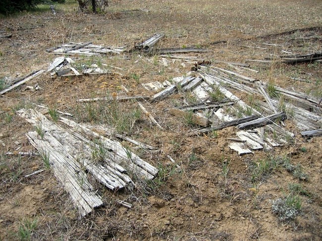
Porcupine Ridge Lookout site 2009