Capitol Peak Lookout Site
US 1160, WA 68
Lookout Details
| Registry Numbers | US 1160, WA 68 (view other lookout sites in United States, Washington) |
| Date Registered | November 27, 2011 |
| Nominated by | Ray Kresek |
| Location |
Washington Coast Thurston County, Washington |
| Coordinates |
N 46° 58.364' W 123° 08.333' (view using Google Maps) N 46° 58' 22" W 123° 08' 20" N 46.972740° W 123.138880° |
| Elevation | 2,658 ft (810 m) |
| Administered by | Washington State Division of Forestry/DNR |
Description
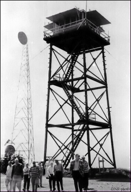
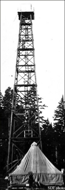
Capitol Peak has one of the most reconstructed and confusing histories of any lookout site. In 1929, a 114' 3-legged wooden tower with elevator to an 84' platform landing and ladder to the top was constructed, but blew down in 1934. The following year a 100' treated timber tower with 8'x8' cab was built, but was removed by the U.S. Army to make room for a radar station in 1942. The following years are even more bizarre and confusing; one source says in 1943 an 83' tower with 7x7' cab was built, and subsequently blew down in 1946. Then a 68' wooden live-in replaced it the same year, and after this tower fell down? in 1954 a 45' wooden tower with L-4 cab came along. Photo evidence does not seem to correspond with this history of structures, as the superstructure seems to resemble an earlier, taller tower which was trimmed to accommodate an L-4 cab (note the unconventional inside trapdoor access to the cab and wide legs at the top, indicating this tower was not built to fit this cab). Whatever the case, this tower was removed in 1967 during the DNR's first round of phasing out lookouts, many of them built and torn down in the same decade.
Map
Change Basemap
Photos
1935