Lookout Details
| Registry Numbers | US 1174, WA 76 (view other lookout sites in United States, Washington) |
| Date Registered | December 16, 2011 |
| Nominated by | Rod Fosback |
| Location |
Colville National Forest Stevens County, Washington |
| Coordinates |
N 48° 52.985' W 117° 32.740' (view using Google Maps) N 48° 52' 59" W 117° 32' 44" N 48.883083° W 117.545667° |
| Elevation | 4,764 ft (1,452 m) |
| Built | 1938 |
| Administered by | U.S. Forest Service |
Description
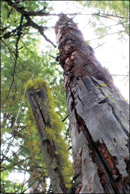
Built in 1938, this rag camp with 40' tree lookout was abandoned after World War II, and now approximately 25' of the tree remain. Early homesteaders named the mountain Electric Point after observing the unusually high number of lightning strikes the mountain attracted. The attractant was discovered to be pure veins of lead 30' in circumference surrounded by copper and iron ore out to 100'. In 1915, the Electric Point Mine began production. During WWII, the importance of lead and copper to the war effort lead the government to establish a fire lookout to minimize disruption of ore production from the Electric Point and Gladstone mines. Perhaps secrecy was behind the temporary name change on 1942 Forest Service maps to Electra Point. The mines outlived the lookout by several decades but are now abandoned with structures and buildings rotting away.