Juniper Point Lookout Site
US 1452, WA 352
Lookout Details
| Registry Numbers | US 1452, WA 352 (view other lookout sites in United States, Washington) |
| Date Registered | November 17, 2012 |
| Nominated by | Ray Kresek |
| Location |
Chelan National Forest Okanogan County, Washington |
| Coordinates |
N 48° 51.761' W 119° 45.308' (view using Google Maps) N 48° 51' 46" W 119° 45' 18" N 48.862680° W 119.755130° |
| Elevation | 4,215 ft (1,285 m) |
| Administered by | U.S. Forest Service |
Description
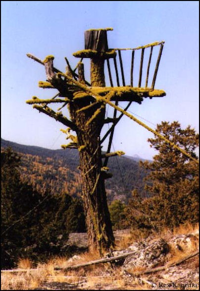
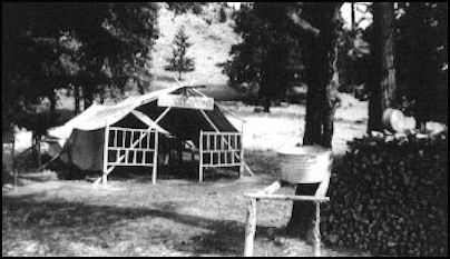
Developed by Lonny Gadberry in the late 1930's for the then Chelan National Forest, this crow's nest tree tower halfway up the south slope of Juniper Point was abandoned in the early 1940's. It remained standing with the help of some recycled telephone wire until it finally collapsed about 2007. Remains of the tent floor, flagpole, woodpile and food cooler remain at the site, which is located within the Loomis State Forest.
Map
Change Basemap
Photos
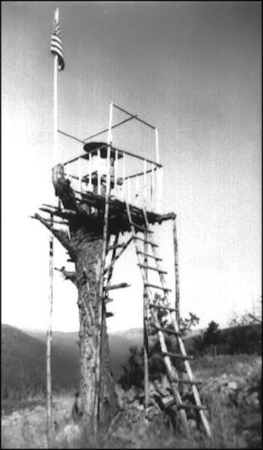
1939
1942