Skalawag Ridge Lookout Site
US 1465, WA 365
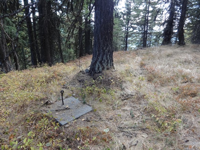
October 2017 photo
Lookout Details
| Registry Numbers | US 1465, WA 365 (view other lookout sites in United States, Washington) |
| Date Registered | November 19, 2012 |
| Nominated by | Ray Kresek |
| Location |
Colville National Forest Ferry County, Washington |
| Coordinates |
N 48° 34.585' W 118° 21.944' (view using Google Maps) N 48° 34' 35" W 118° 21' 57" N 48.576413° W 118.365740° |
| Elevation | 5,522 ft (1,683 m) |
| Administered by | U.S. Forest Service |
Description
A 35' limber pole platform and log cabin, built in 1930 was replaced in 1934 with a 60' pole tower with 7'x7' cab 1/2 mile southeast of summit. A pole platform tower was also built 2 miles northwest. The ruins were still there in the 1980s. The lookout was abandoned in the 1950s.
Map
Change Basemap
Photos
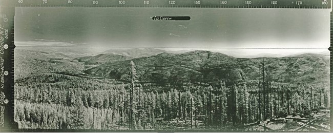
Skalawag Ridge Lookout panoramic 9-29-1934 (N)
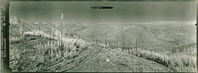
Skalawag Ridge Lookout panoramic 9-29-1934 (SE)
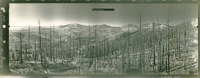
Skalawag Ridge Lookout panoramic 9-29-1934 (SW)
Visit Reports
October 16, 2017: Rod Fosback
Condition |
|
| Comments: | The site is overgrown but concrete footings and various lookout parts lay about. |
Electronics and Enroachments |
|
| Are electronic sites enroaching on tower? | No |
Access and Signs |
|
| Directions to tower signed? | No |
| Comments? | The old jeep trail leading the site has been recently gated and now requires a 2 mile hike to reach. |
Other Comments |
|
| Comments | Early Forest Service maps dating 1928-1943 spell it as Skalawag Ridge. Later maps from 1952 on changed the spelling to Scalawag Ridge. |