San Gabriel Peak Lookout Site
US 1852, CA 47
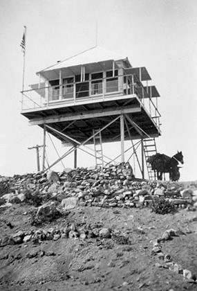
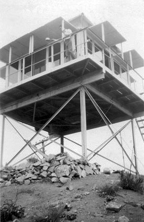
San Gabriel Peak Lookout
Lookout Details
| Registry Numbers | US 1852, CA 47 (view other lookout sites in United States, California) |
| Date Registered | December 4, 2019 |
| Nominated by | Brad Eells |
| Location |
Angeles National Forest Los Angeles County, California |
| Coordinates |
N 34° 14.595' W 118° 05.915' (view using Google Maps) N 34° 14' 36" W 118° 05' 55" N 34.243242° W 118.098577° |
| Elevation | 6,165 ft (1,879 m) |
| Built | 1935 |
| Removed | Unknown |
| Administered by | US Forest Service - Angeles National Forest |
Description
San Gabriel Peak Lookout was a California Region 5 Plan 4A cabin on a 10 foot X-Brace open steel tower constructed as early as 1922 and may have later been replaced by a BC-301 design.
Map
Change Basemap
Photos
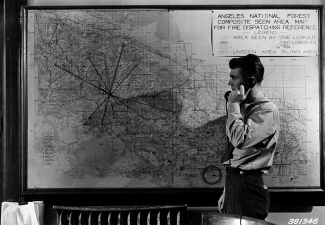
Fire dispatcher’s office, Pasadena, showing fire map and string stretched to indicate azimuth readings from different lookouts on a fire