Tecate Peak Tower Site
US 521, CA 7
Lookout Details
| Registry Numbers | US 521, CA 7 (view other lookout sites in United States, California) |
| Date Registered | April 13, 2009 |
| Nominated by | Brad Eells |
| Location | San Diego County, California |
| Coordinates |
N 32° 34.761' W 116° 41.000' (view using Google Maps) N 32° 34' 46" W 116° 40' 60" N 32.579350° W 116.683330° |
| Elevation | 3,049 ft (929 m) |
| Administered by | California Department of Forestry and Fire Protection (CalFire) |
Description
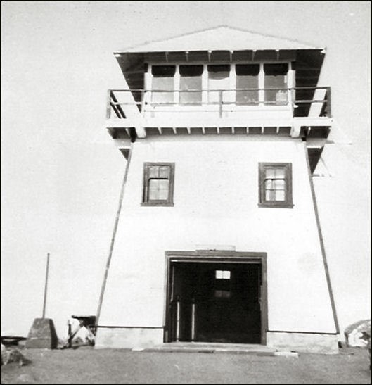
Tecate Peak sits almost astride the US-Mexico border. The design is likely a National Park Service Plan 7 similar to structures constructed at Boucher Hill and Los Pinos: A 20 foot enclosed, battered timber tower with a 14x14 wood cab. The lookout served the area for at least 40 years before being demolished sometime after 1975.
Map
Change Basemap
Photos
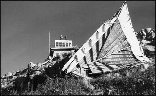
Lookout With Roof Off
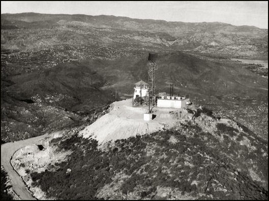
Distance View